Top Attractions
7 Must-See Places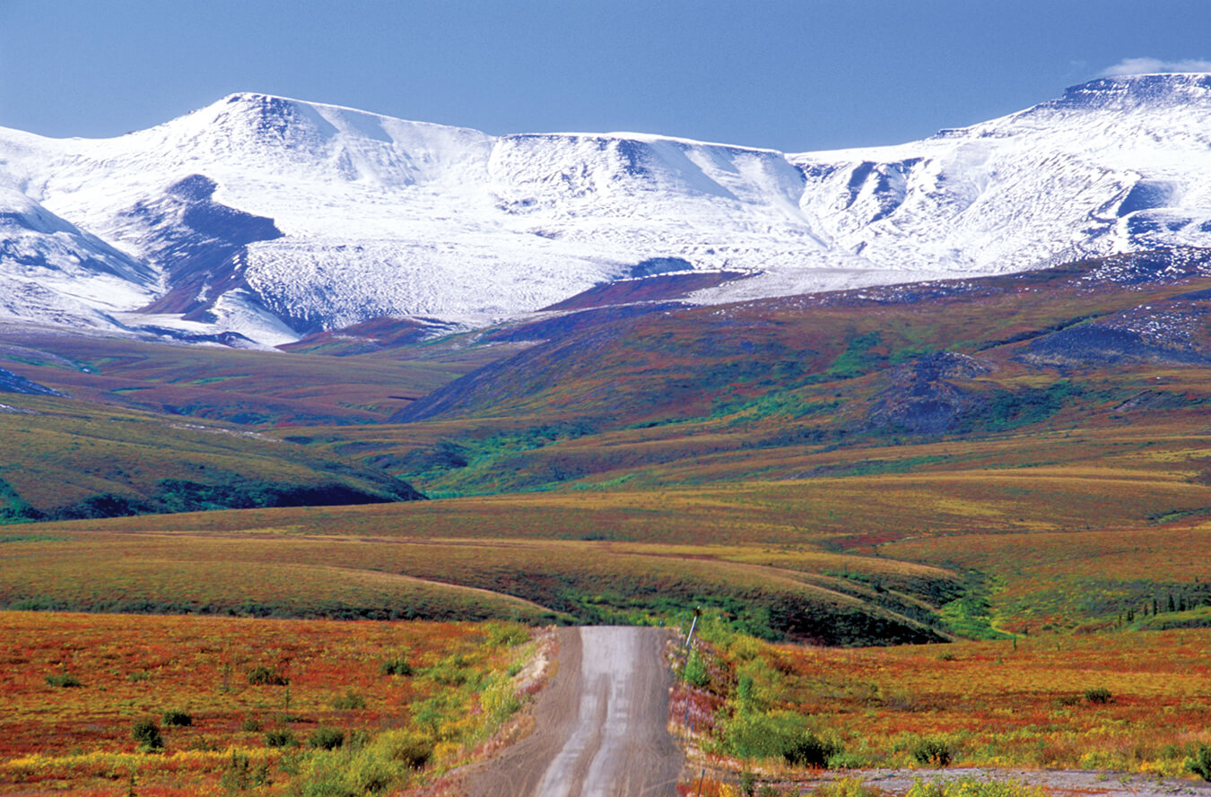
Dawson City
At the confluence of the Yukon and Klondike rivers, Dawson City was the heart of the 1896 Klondike Gold Rush — briefly the largest city west of Winnipeg and north of Seattle. The historic townsite, the Palace Grand Theatre, the Dredge No. 4 National Historic Site, and the Diamond Tooth Gerties gambling hall collectively preserve the gold rush era with authentic detail.
View full guide →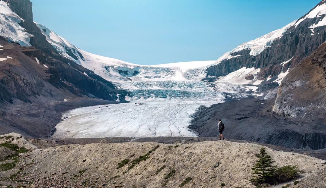
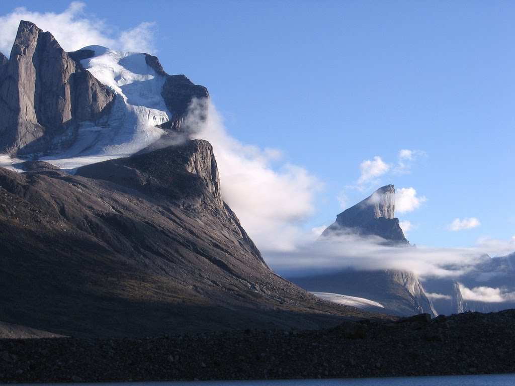
Kluane National Park
Home to the world's largest non-polar icefields and the highest peaks in Canada, Kluane is a UNESCO World Heritage Site of exceptional scale. Mount Logan, Canada's highest mountain at 5,959 metres, is in the park. The park's grizzly bear population is one of the most studied in the world. Glacier walks, flightseeing tours, and wilderness backpacking are the primary activities.
View full guide →
Whitehorse
The capital of the Yukon sits on the Yukon River and is the territory's cultural and service hub. The S.S. Klondike National Historic Site — a retired sternwheeler used to supply gold rush communities — is on the river bank. The Yukon Beringia Interpretive Centre covers the Ice Age ecology of the Yukon, including woolly mammoths and short-faced bears.
View full guide →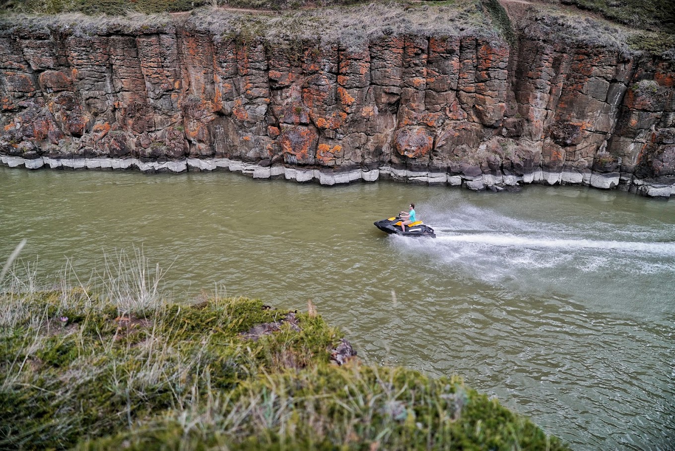
The Dempster Highway
The Dempster Highway runs 736 kilometres from the Klondike Highway near Dawson City north to Inuvik in the Northwest Territories, crossing the Arctic Circle. It's the only public road in Canada to cross the Arctic Circle. The landscape changes from boreal forest through alpine tundra to subarctic delta as you travel north — extraordinary in all seasons.
View full guide →
Carcross Desert
A small but striking sand desert near the village of Carcross — the remnants of an ancient glacial lake bed, kept in perpetual sand dune formation by dry winds from Bennett Lake. Often called the world's smallest desert (though technically a dryland ecosystem rather than a true desert), it's a remarkable geological oddity in an otherwise forested landscape.
View full guide →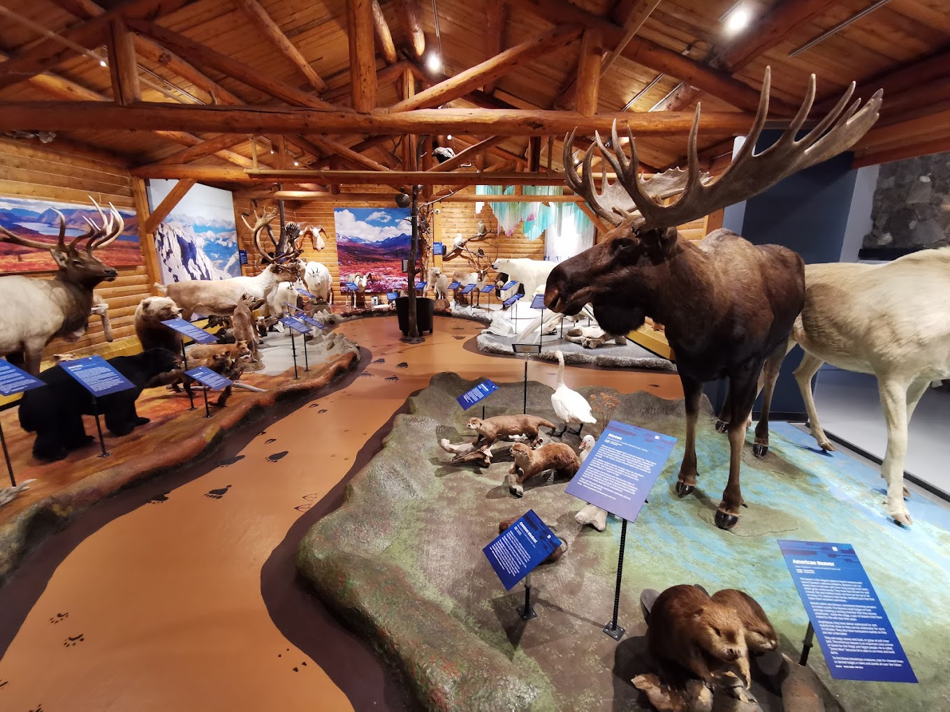
Miles Canyon & Yukon River
Miles Canyon is where the Yukon River squeezes between columns of basalt just south of Whitehorse, creating the stretch of whitewater that gold rush stampeders had to navigate — or portage around — in 1898. Today a suspension footbridge spans the canyon and a network of trails along both banks makes for an excellent half-day of walking. The Yukon River is glacially clear here, and the geology of the canyon walls is striking. The Miles Canyon Historic Railway site nearby interprets the narrow-gauge railway that bypassed the rapids during the gold rush. It's a ten-minute drive from downtown Whitehorse.
View full guide →
Tombstone Territorial Park
Tombstone Territorial Park protects one of the most dramatic landscapes in the Yukon — a high tundra wilderness of jagged granite peaks, permafrost polygons, and valleys that have been home to the Tr'ondëk Hwëch'in people for thousands of years. The Interpretive Centre at Km 71 of the Dempster Highway is an excellent introduction to the park's ecology and First Nations history. Day hikes from the highway reveal sweeping vistas of the Tombstone Range; multi-day backcountry routes require permits and experience. Fall colour in the tundra, typically peak in mid-September, is one of the most spectacular natural displays in Canada.
View full guide →Yukon Travel Guides
The Yukon Gold Rush: History, Trails and Dawson City
The Klondike Gold Rush shaped Canada. The Chilkoot Trail is one of the most historically immersive hikes in the country.
Chasing the Northern Lights in Yellowknife
The NWT's capital sits under the auroral oval — one of the world's most reliable aurora viewing destinations.
Baffin Island: Planning an Arctic Adventure
One of Canada's last true wildernesses — glaciers, fjords, and polar bears at the roof of the world.
Share Your Yukon Experience